
 Photo Credit: National Weather Service
News
Tropical Storm Warning issued for Montgomery County
On Sunday, July 7th at 10:30 a.m. the Montgomery County Office of Homeland Security and Emergency Management shared an update that a Tropical Storm Warning has been issued for Montgomery County. Read updates below.
A Tropical Storm Warning has been issued for Montgomery County.
Peak wind forecast: 45-60 mph wit[h] gust[s] to 85mph
Window for Tropical Storm force winds: Early Monday Morning through Monday afternoon.
THREAT TO LIFE AND PROPERTY is possible. complete Preparations TODAY!
Significant impacts expected.
* Some damage to roofing and siding materials, along with damage to porches, awnings, carports and sheds. Mobile homes damaged especially if unanchored.
*secure outdoor items and lightweight objects so they don’t become projectiles.
*Large trees can become uprooted or snap.
Starting tomorrow please avoid being on the roadways and stay home if at all possible.

Montgomery County Judge Mark Keough shared a statement at 10:39am:
“A tropical storm warning has been issued for Montgomery County. I urge all residents to finalize perpetrations today! Stay home tomorrow (Monday July 8, 2024) if at all possible. Conditions will not be favorable to be out on the roads. County offices will be closed tomorrow. All essential personnel will be on duty and working.”
On Sunday, July 7th at 8 a.m. the Montgomery County Office of Homeland Security and Emergency Management shared the following update:
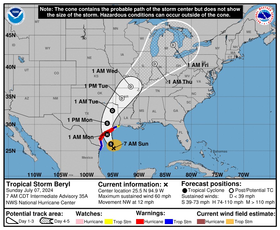
A shift in the forecast track overnight for Tropical Strom Beryl soon to be Hurricane Beryl. The track shift is closer to Montgomery County now upon landfall Beryl is expected to move north east over Monday in our area.
The center of circulation is expected to be just west of Magnolia as Beryl passes by Montgomery County. This will put us on the “dirty” side of the storm and much closer to the center of circulation where the strongest winds are located.
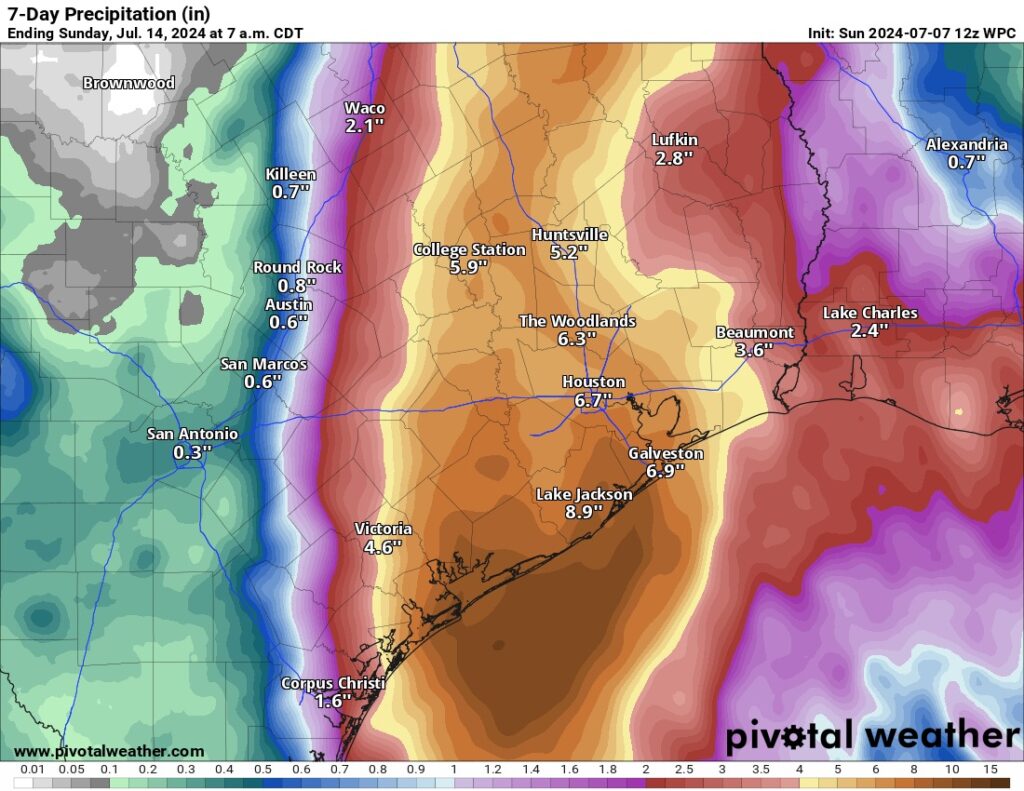
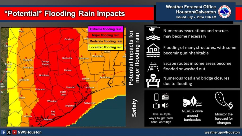
What to expect: Heavy rains starting today and ending late Monday night. 5-10 inches are still forecasted with areas West of 45 seeing higher amounts. The entire county is under a Flood Watch thru Tuesday.
Winds: We can start to see gusty winds later today with sustained wind speeds expected to be less than 60mph. With stronger gusts closer to the center, depending on where track goes. Expect stronger winds if you are west of I-45.
Today is your last day to make preparations and gather supplies. Ensure you have enough water and food for all members of your household to include pets. Fuel up your cars and make sure you have all your prescriptions. Keep in mind that power outages are possible when purchasing food supplies.
The county’s Emergency Operations Center is currently activated at Level 3, and will transition to Level 1 (Maximum Readiness) this evening and will remain activated until the threat has diminishes.
Judge Keough has signed a disaster declaration this morning in advance of Hurricane Beryl’s Landfall. This has activated the county’s emergency operations plan and ensured all local resources and assets are available to ensure we are able to protect life and property as much as needed. This is in addition to the disaster declaration already signed by Lt. Gov. Dan Patrick.
Stay weather aware. Starting this afternoon more frequent postings will come out with additional details. Should any watches or warnings be issued we will also update in real time.