

 Photo Credit: National Weather Service
News
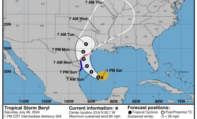
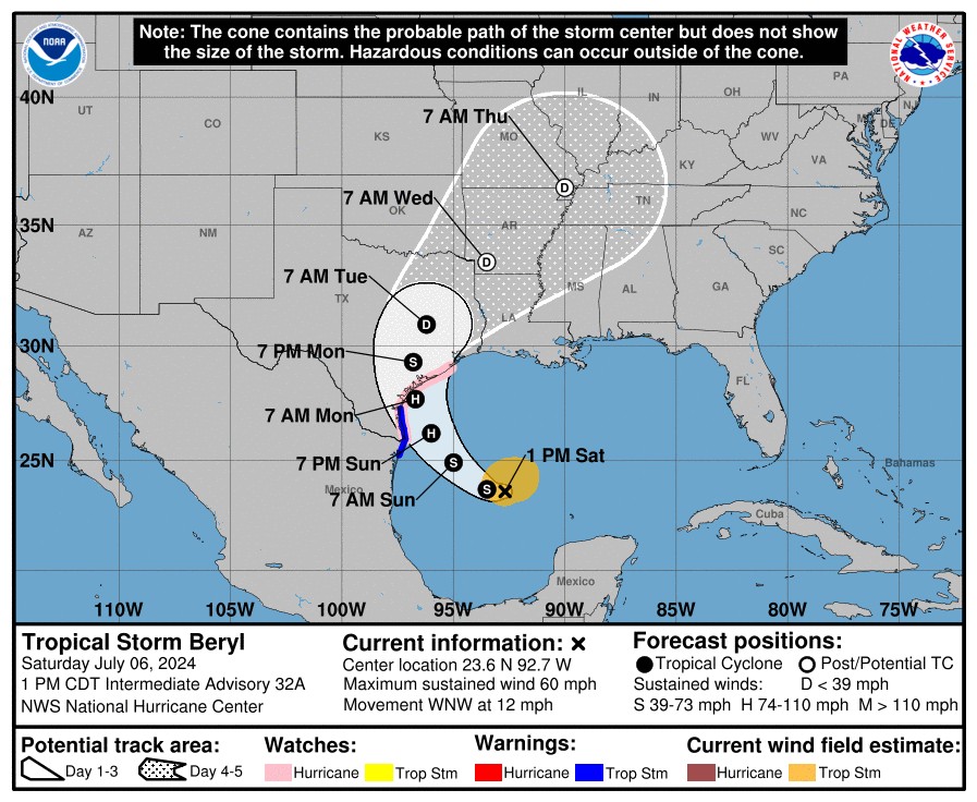
July 6 1pm Update: Tropical Storm Beryl continues to move towards landfall with the Texas coast
The Montgomery County Office of Homeland Security and Emergency Management shared the following update on Saturday, July 6 at 1 p.m.:
Tropical Storm Beryl continues to move towards landfall with the Texas coast. Current forecast track has not changed much since this morning and we are still expecting landfall in or around the Matagorda Bay area.
Should this forecast hold we will see our heaviest rain on Monday with the potential for some tornadoes on Monday as well. Accumulation of rain is gradient from lowest in East Montgomery County to highest in West Montgomery County. General 5-10 inches is expected Early Monday thru Tuesday. No significant flooding is forecasted at this time.

Should the track move more in our direction we could see higher rainfall amounts and some tropical storm force winds. But for now we are not expecting to see sustained wind speeds at tropical storm levels.
If you are West of I-45 you will see higher chances of rainfall and potentially gusty winds on Monday. Areas east of I-45 will generally see less rain chances/accumulation and lower chances of gusty winds.
Next update after 5pm. Please stay weather aware and only share information from reputable sources or from OEM.

Source: Montgomery County Office of Homeland Security and Emergency Management